Project Qualification Geospatial Innovation
The Geospatial Innovation pathway, through its flagship Bloxham Sustainability Challenge, provides the structure, support and real-world context for centres to deliver a geospatial investigation. Delivered in partnership with Dalcour Maclaren and supported by Esri’s ArcGIS Online platform, the challenge enables students to develop GIS, sustainability and digital skills while completing a Project Qualification through collaborative, real-world enquiry.
Geospatial Innovation: The Bloxham Sustainability Challenge
The Geospatial Innovation pathway is delivered through the Bloxham Sustainability Challenge (BSC), a flagship, GIS-enabled investigative project that enables learners to combine technical expertise with creative problem-solving in response to real-world sustainability challenges.
Using live datasets updated annually, the Bloxham Sustainability Challenge provides a structured yet flexible framework through which students develop specialist geospatial skills alongside essential hard and soft skills, including digital literacy, oracy, collaboration and critical thinking.
Learners work in teams of three to five within the Bloxham Sustainability Challenge, planning, executing and evaluating an investigation that explores how geospatial technologies can be used to address complex sustainability issues. While a central enquiry question provides focus, each learner has the opportunity to develop a specialist area of interest within the broader investigation.
As part of the Challenge, teams present their findings collectively to a panel of stakeholders using professional industry tools such as ArcGIS, Survey123 and StoryMaps. Alongside this, each team produces a professionally structured Sustainability Impact Assessment (SIA) report, demonstrating depth of understanding, analytical rigour and applied expertise.




The Bloxham Sustainability Challenge is delivered through a collaborative partnership between Bloxham School and Dalcour Maclaren, and is underpinned by Esri’s ArcGIS Online platform, provided free for all schools. This partnership ensures that the project reflects current industry practice and directly addresses skills shortages in geospatial technologies and the rapidly growing green economy, particularly in areas such as sustainability planning and digital decision-making. The annual Challenge launch is hosted at the Royal Geographical Society (with IBG), London.
Learners will develop the capacity to solve problems and make informed decisions using geospatial evidence, while embedding an understanding of global citizenship and sustainability. They will learn to integrate complex issues such as climate resilience, equitable access to resources and the interconnections between environmental, social and economic systems.
Learners also gain hands-on experience in specialist GIS techniques, including:
- Data capture and fieldwork integration
- Spatial analysis and interpretation
- Advanced visualisation and digital storytelling
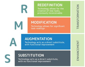
Importantly, the Bloxham Sustainability Challenge places learners within the Modification and Redefinition stages of the SAMR model (see Figure 1). By using GIS not merely as a substitute for traditional mapping but as a transformative tool, learners move beyond enhancement to create new learning experiences and outputs that would not be possible without technology. In doing so, this pathway helps students apply technology meaningfully to real-world sustainability challenges.
Figure 1: The SAMR Model – Four Stages of Technology Integration for Learning Transformation
In joining the Geospatial Innovation pathway through the Bloxham Sustainability Challenge, schools offer their students far more than a standalone project. They gain access to a rigorous, industry-aligned qualification experience that builds confidence, competence and real-world readiness.
Each school is supported through:
- Fully structured teaching and delivery resources
- Annual live datasets linked to real-world challenges
- Free access to ArcGIS Online
- A dedicated GIS mentor from Dalcour Maclaren
- The Innovation Exchange webinar series
- A comprehensive GIS Toolkit including demonstrations, walkthroughs and ready-to-use guidance
These elements ensure that, regardless of prior GIS experience, both teachers and students are supported to succeed within the Bloxham Sustainability Challenge framework.
Figure 2: The Bloxham Sustainability Challenge Framework
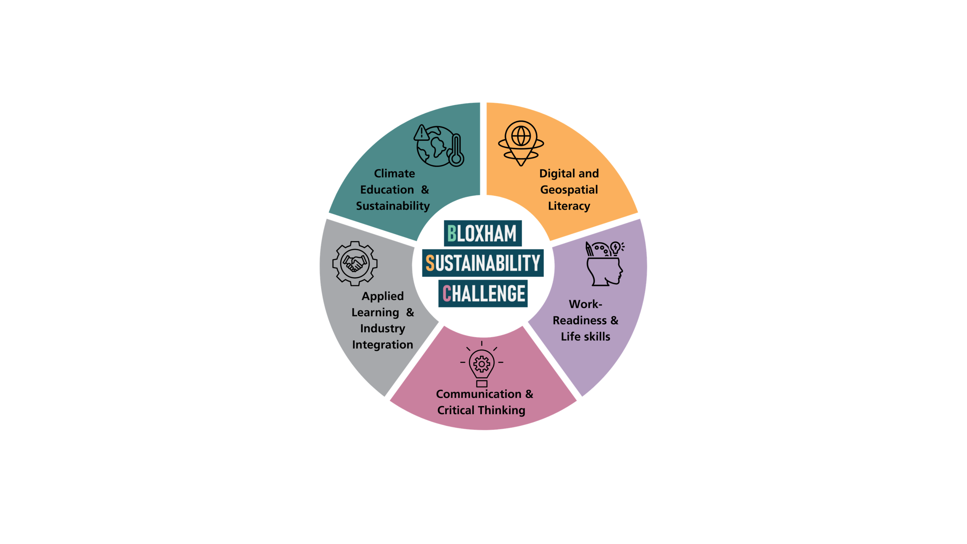
The Bloxham Sustainability Challenge integrates a range of core competencies, bringing together geospatial, sustainability and employability skills within a single, coherent framework (see Figure 2).
By integrating specialist geospatial skills with sustainability, critical thinking and digital literacy, the Geospatial Innovation pathway - through its flagship Bloxham Sustainability Challenge - empowers students to think critically, act creatively and develop capabilities that universities, employers and global industries increasingly demand.
It is a future-focused programme that equips young people to become informed, innovative problem-solvers in a rapidly changing world.
- Find out more about the Bloxham Sustainability Challenge
- Contact the Bloxham Sustainability Challenge
- Bloxham Sustainability Challenge information booklet
- Bloxham Sustainability Challenge supporting webinar series (2026-27)
- Examples of student impact (links to podcasts, conference presentations and student exemplars)
- Guidance for Centres: FAQs about the Bloxham Sustainability Challenge